What Does Cycling in Oxford Actually Feel Like? Now We Have the Data
The evidence gap in cycling safety
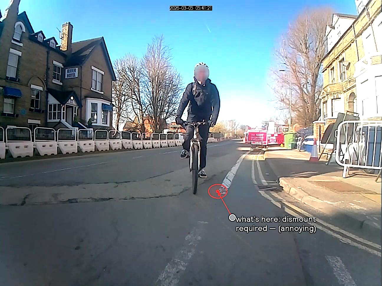
On Headington Road, the tarmac is half finished on the cycle lane. There's a lamppost where the lane should be.
A few miles away, on Woodstock Road, the cycle lane exists, but it's regularly parked on by van and lorry drivers. On London Road, it's the surface itself: potholes and cracked tarmac that push riders into traffic. At The Plain roundabout, one approach arm guides cyclists into the blind spot of left-turning vehicles.
But how does any of that reach the people who can actually fix it? A pothole gets logged on Fix My Street and quietly closed. A near miss happens and the cyclist rides on, because who do you even tell? One person's experience of Woodstock Road proves nothing. A hundred people's experience, classified and mapped, is a different conversation entirely.
Most road safety planning relies on collision records: incidents serious enough to involve the police or an ambulance. This is essential data, but it only captures the worst outcomes. The near misses, the obstructed cycle lanes, the junctions that could be improved but haven't seriously hurt anyone yet don’t appear any one centralized dataset, until now.
Turning rider experience into usable evidence
As part of the EU-funded SOTERIA project, Onsee and Oxfordshire County Council have been evaluating a method to capture that missing evidence. Cyclists equipped with a handlebar-mounted camera and GPS unit flag events during their ride at the press of a button. Each flagged event is later reviewed and classified using a structured taxonomy covering hazard type, subcategory, severity, and exact location, with annotated video frames attached as evidence. The result is a georeferenced dataset of cycling hazards, specific enough to identify not just where problems cluster, but what kind of problems they are, and therefore what kind of interventions are needed.
What Oxford's roads revealed
We hand-picked 35km of data collected across the Oxford pilot area, covering key corridors including Woodstock Road, London Road, Banbury Road, Botley Road, and the city centre network. The data spans segregated tracks, painted lanes, shared-use paths, and mixed-traffic roads. Ninety-one hazard events were classified across eight conflict categories, at an observed rate of 2.6 events per kilometre.
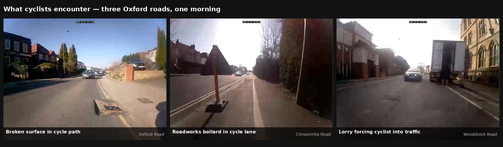
What cyclists encounter — broken surface, roadworks obstruction, and lorry forcing cyclist into traffic across three Oxford roads
Different roads, different problems
The data told different stories about different roads. London Road was overwhelmingly a surface problem — 60% of its recorded hazards were potholes, cracked tarmac, and rough stretches that force riders out of the cycle lane and into traffic. Woodstock Road was something else entirely: vans and lorries parked in the cycle lane, a close overtaking pass, a junction conflict. The road surface is fine — the problem is vehicles treating the cycle lane as parking spaces. At The Plain roundabout, we used the data to survey the cycling infrastructure on each of the five approach arms: from post-protected lanes to painted markings to no dedicated provision. The annotated footage from the rider's perspective highlighted how cyclists navigated each approach. Engineering drawings show what's been built, but this shows how it's experienced by the people using it.

57 geolocated hazard incidents across the Oxford demonstration area, colour-coded by conflict type
Evidence that can drive action
What makes this useful isn't just the numbers - it's the specificity. Knowing that London Road has a surface problem and Woodstock Road has an obstruction problem means the response to each can be different and targeted. Knowing what The Plain looks like from the saddle, on each approach, gives planners something that wasn't previously available without sending someone out to ride it. As more cyclists contribute data across Oxford, that picture becomes sharper and sharper. It’s a way forward that builds the kind of evidence base that moves cycling safety from anecdote to something decision-makers can act on.
The piece has been authored by ONSEE
- Log in to post comments